A Tool for Enriching Map Data
In Gojek's transport and food delivery services, over 85% of transport pickup locations are users’ detected location, and over 85% of food orders are delivered to the users’ location. Customers can select from well-labeled pickup locations, removing the necessity to describe their whereabouts to drivers. These points are widely recognised spots, enhancing the overall user satisfaction. The infrastructure and data contribution for this experience is largely managed by Gojek's Maps Operations team. They employ the Cartography app to increase the availability of place information and enhance map data coverage. The application empowers the team to develop and maintain comprehensive mapping data, such as road systems, traffic behavior, points of interest, pickup and drop locations, parking areas, and more. This significantly boosts the precision of pickups and the rate of successful bookings.
Gojek
8 months
Cartography
My Role
I was the sole designer on the project and worked closely with the leadership, product manager and engineers of the Cartography team. I also worked with the Transport and Food product teams and the Cartography Team to integrate product requirements to the app.
Research and Insights
I began by conducting interviews with the Maps Ops team members. The purpose of these interviews was to comprehend the emotions, needs, and behavior of the end users. The objective was to determine: How frequently do users engage with the current app? What emotions do users experience when interacting with the current app? Are there any frustrations or aspects they appreciate? What does their workflow entail? Do they utilize any specific terminology? Are there any additional features that could simplify their lives? Have they used any comparable tools alongside the app?
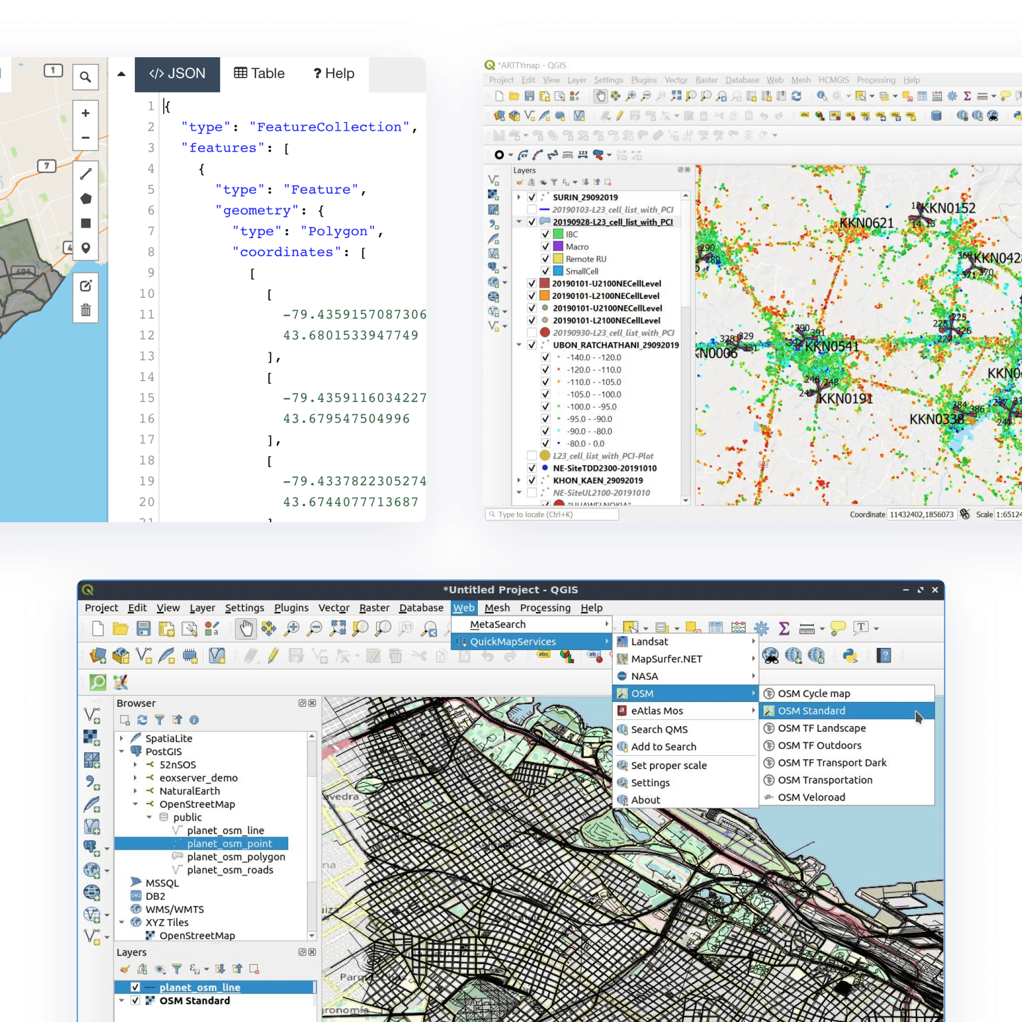
The Cartography app serves as the primary tool for the Maps Ops team. They guided me through the app and related tools like Open Street Maps, QGIS, and geojson. They devote a significant portion of their day to the app. The main issues identified by the users included: Ambiguous processes, inadequate information and feedback, absent form fields. Users suggested features such as: displaying existing polygons while creating new ones to prevent overlaps, full-screen maps, potential language expansion, and a country switcher due to usage in four countries.
How might we create a reliable and scalable mapping solution that reduces dependency on third party vendors, provides flexibility in addressing upcoming use cases and customisation capabilities, enhances data security, and integrates smoothly with existing workflows?
What does success look like
Efficient and faster workflows
Increase in pickup adoption rate
Rise in destination adoption rate
Reduction in pickup accuracy
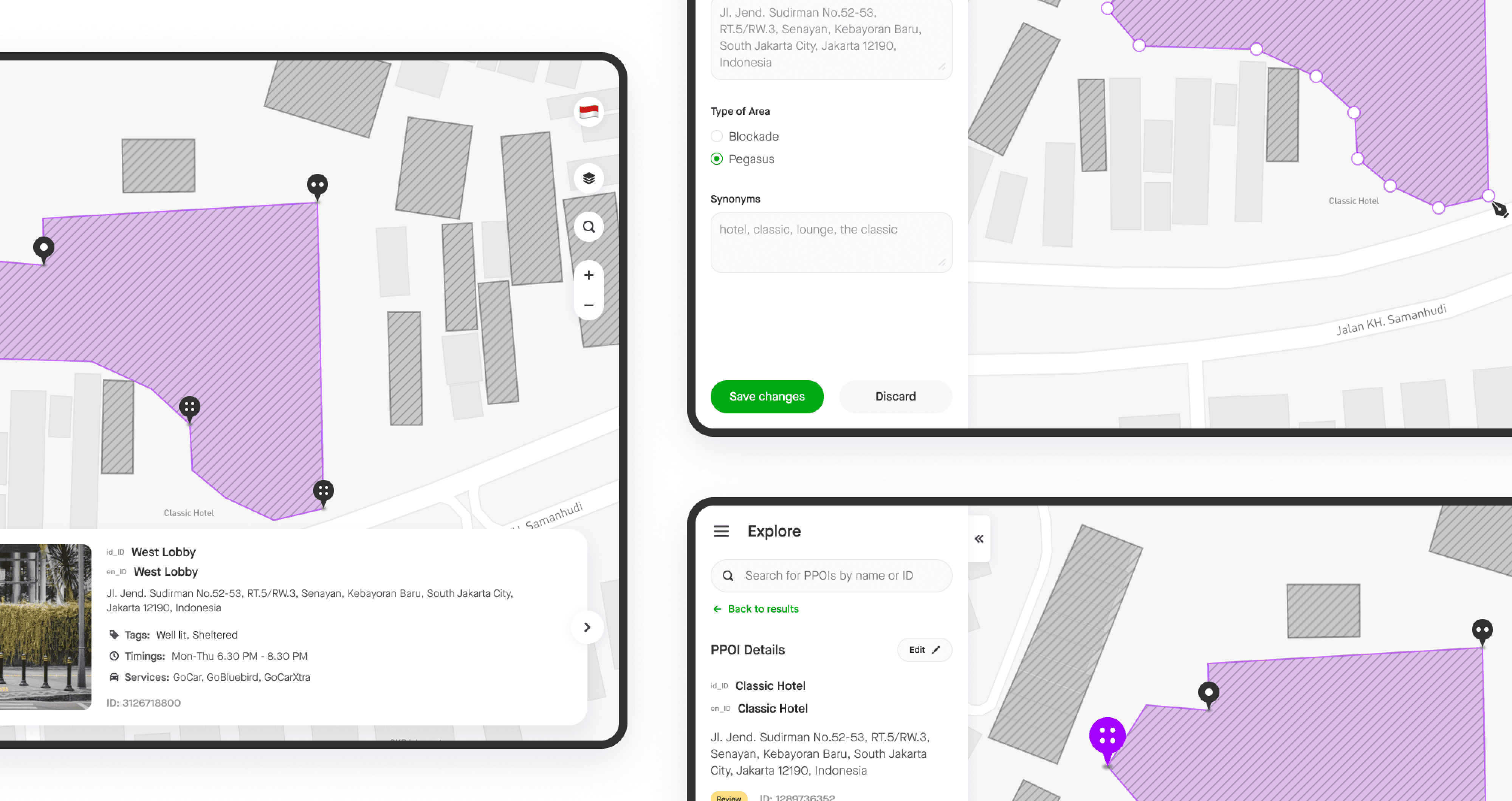
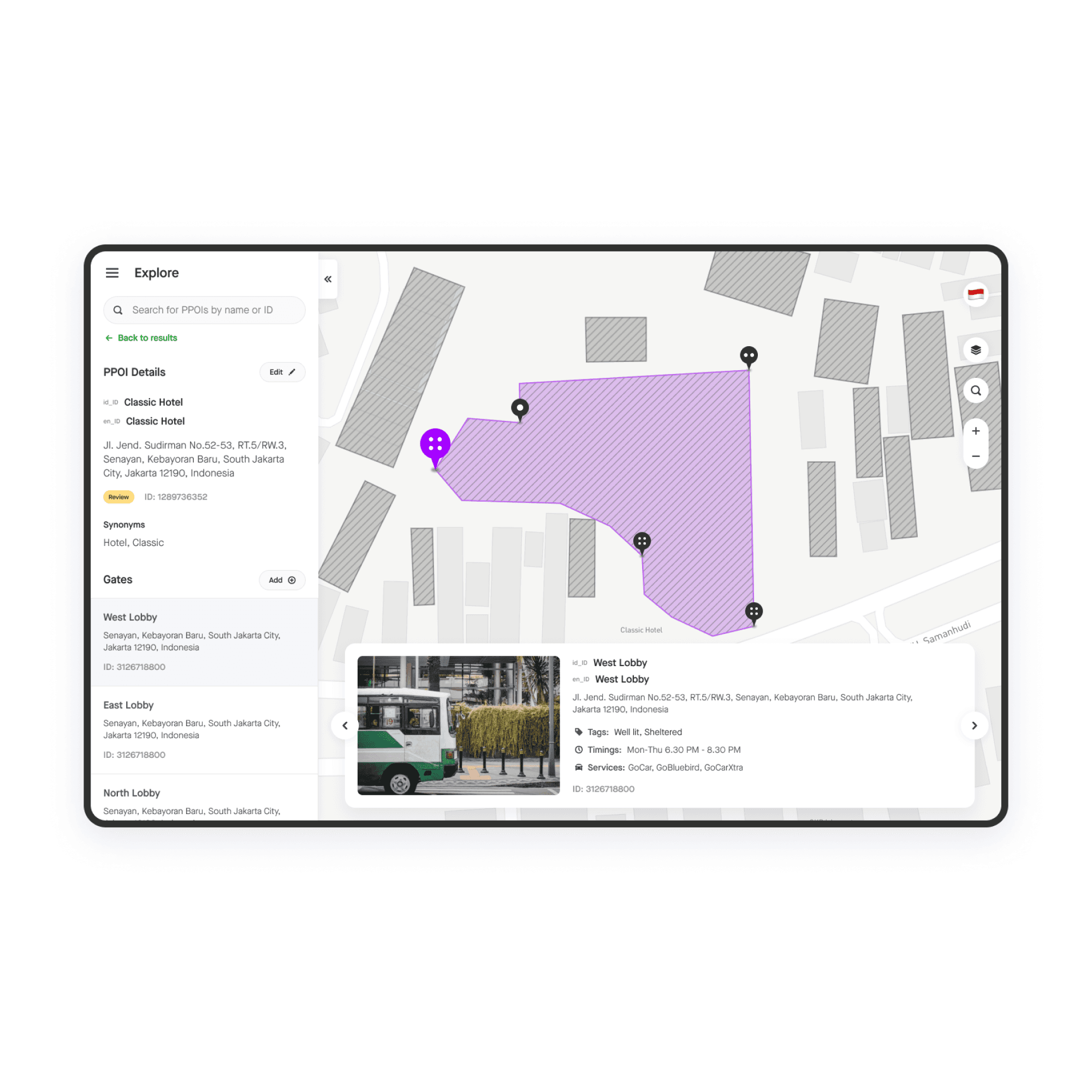
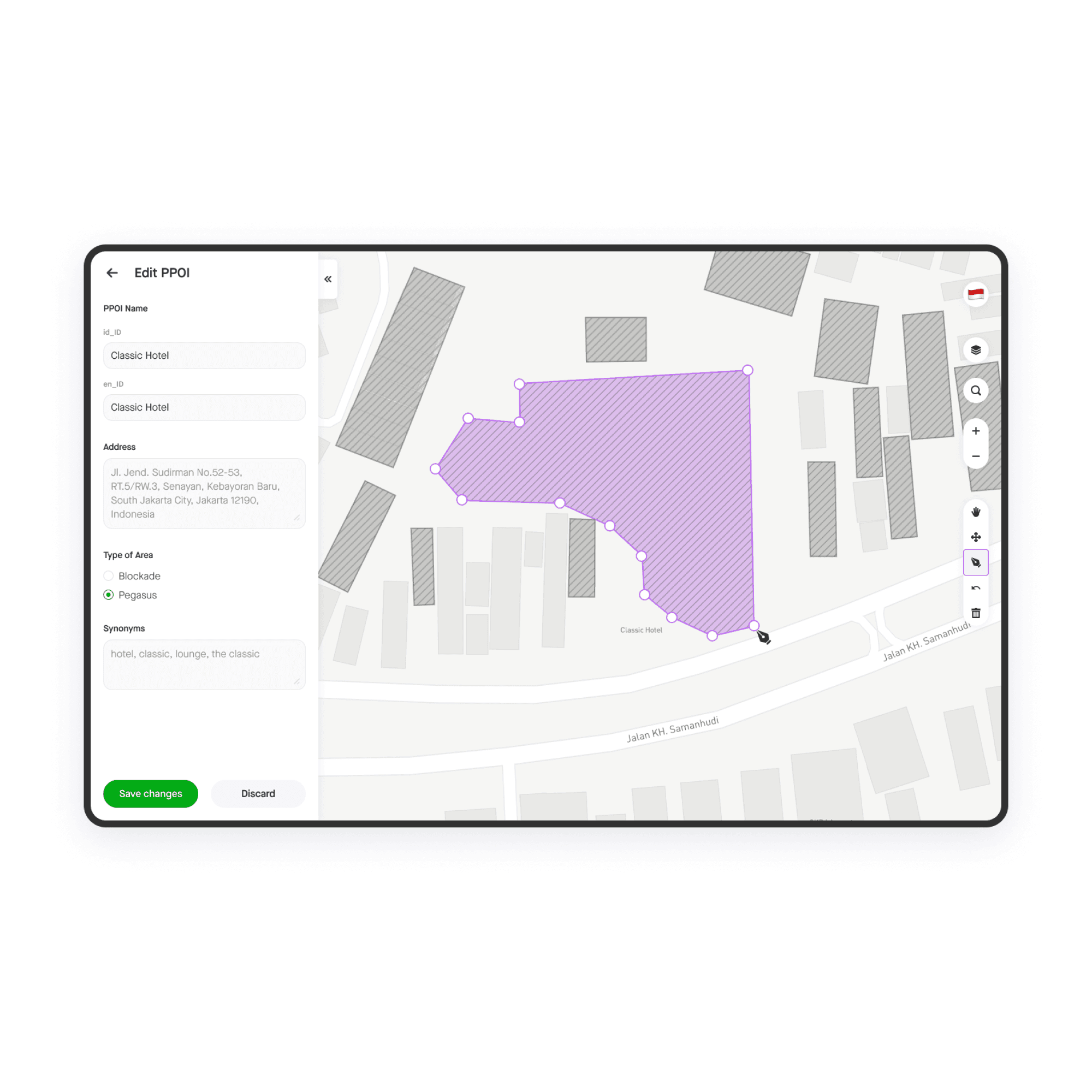
Final Design
Based on the pain points listed by the users, I fixed the users flows and information architecture. I closely collaborated with the engineering team while creating the designs as there were some constraints due to the existing infrastructure. The visuals for the new app were designed using Asphalt Web Design System. I decided to use a light grey theme for the map so that user generated data like polygons and points would stand out.

Impact
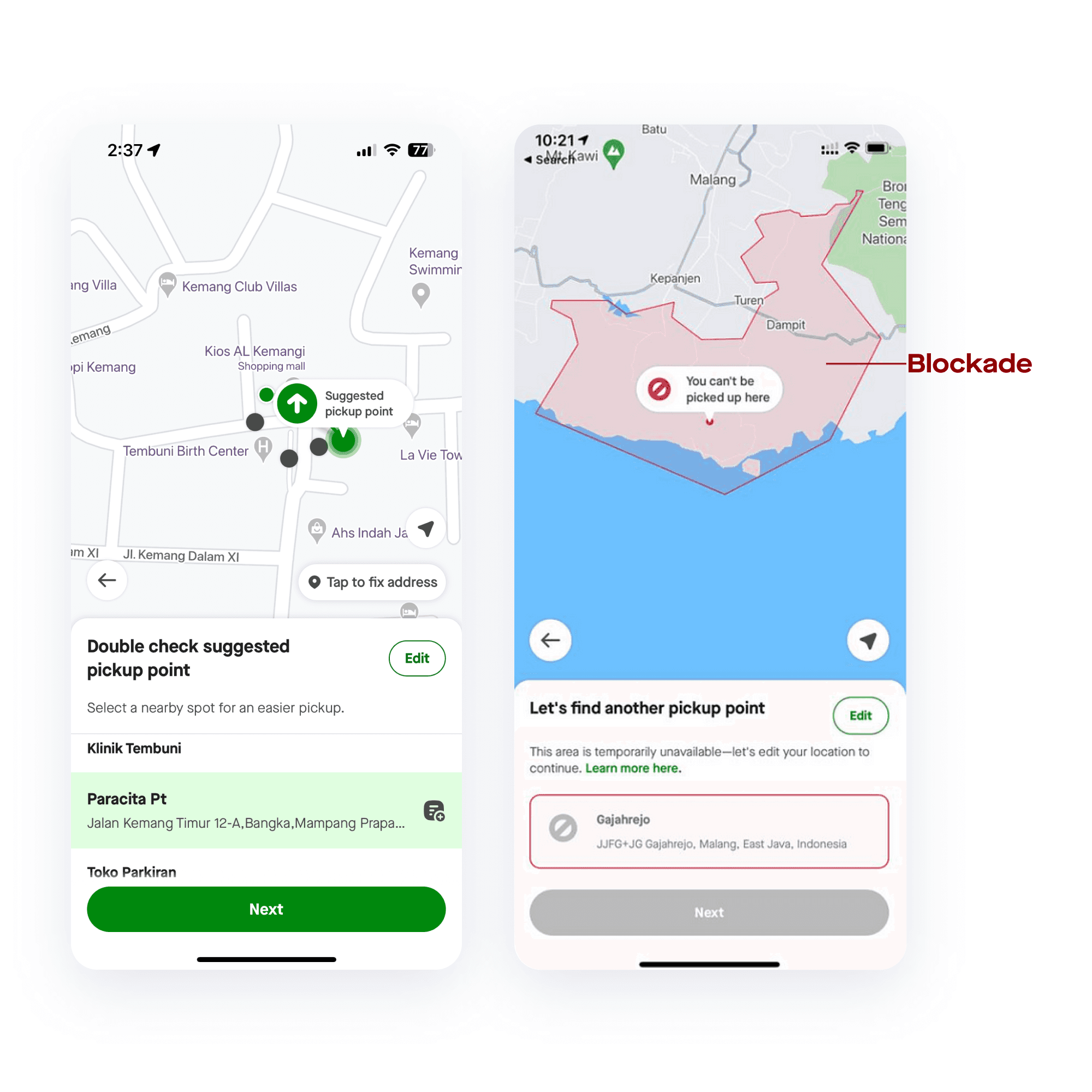
Observing and understanding map data like routes and locations chosen by users, allows the maps ops team to make relevant updates to the underlying map data. This contributes to a better customer experience by immensely improving the typeahead location search. These updates also allow incorporation of alternate and more detailed routes and locations like routes within housing, apartment, and mall complexes. The app is being used by Maps Ops teams in 4 countries - Indonesia, Singapore, Thailand and Vietnam.
In a span of 6 months, the Cartography app enabled the team to increase areas of interest by 5000 and pick up points by 13000 in Indonesia, and 1,01,000 areas of interest and 1,10,000 pick up points in Singapore
This increased pickup point adoption rate from 10% to 14% in Indonesia and 0.4% to 57% in Singapore
This also led to an increase in destination adoption rate from 0.8% to 2% in Indonesia and 0.1% to 9% in Singapore
Pickup accuracy was reduced by 4 meters from 31 meters to 27 meters in Indonesia and by 1 meter from 30 meters to 29 meters in Singapore
The app played a vital role in 2020, a period marked by frequent government regulation changes due to the pandemic. It allowed for real-time adjustments to reflect lockdowns and road closures in the pickup experience.